New Study Identifies Toxic Feedback Loop Along Newtown Creek

State regulators have homed in on 41 properties along Newtown Creek that may be leaking pollution back into the waterway. 

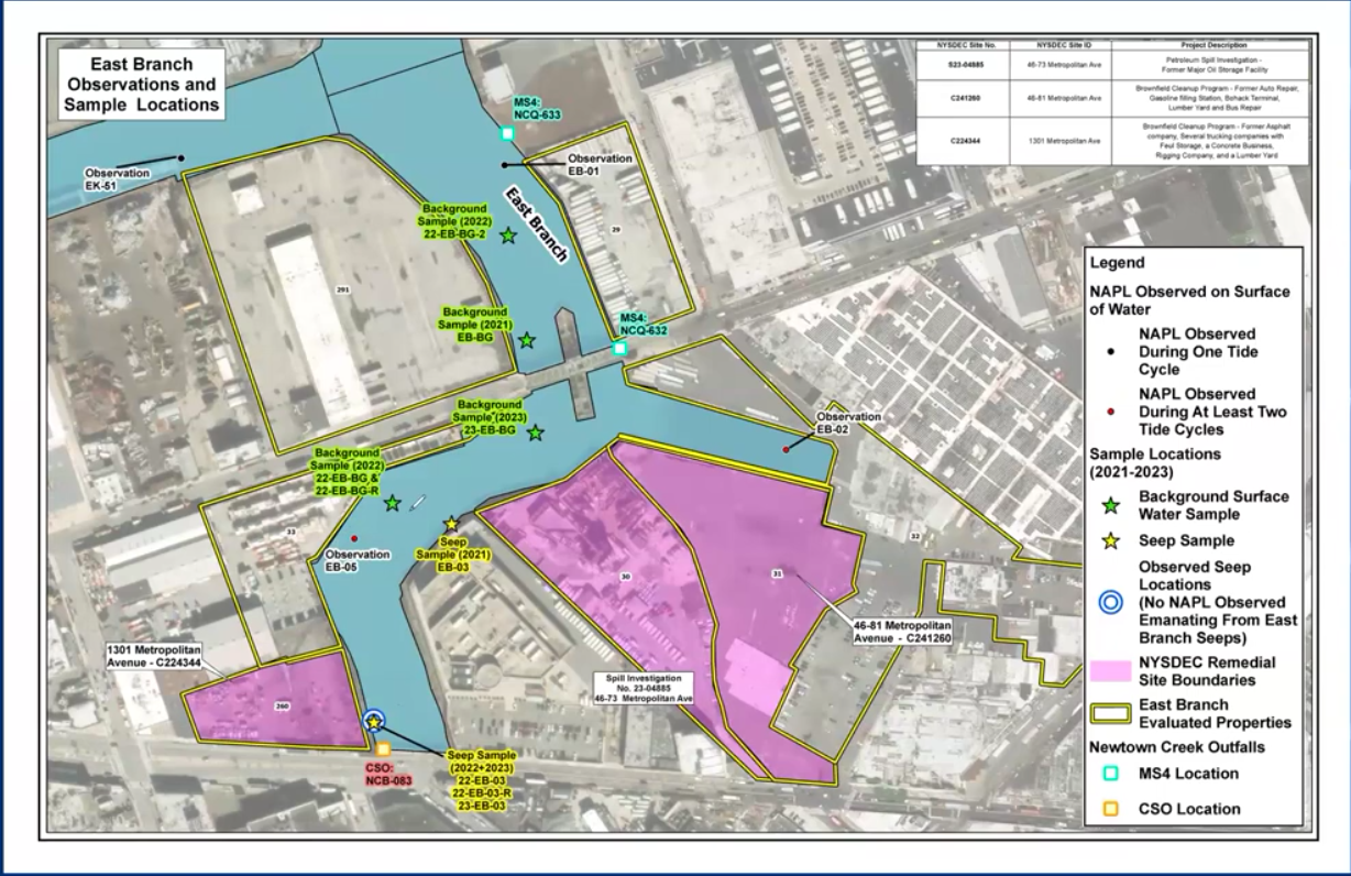
A map showing Newtown Creek’s East Branch, with locations with potential contamination marked.

By COLE SINANIAN | news@queensledger.com

The New York State Department of Environmental Conservation (DEC) has identified 41 sites along Newtown Creek that could be contaminating the waterway with petroleum residue and other chemicals leftover from its long history of industrial use. 

The DEC’s NYC Mega Projects coordinator Heidi-Marie Dudek presented the findings of the agency’s Newtown Creek Upland Study over Zoom at a community meeting in Long Island City on November 19. Between 2021 and 2023, regulators surveyed 155 properties bordering the creek, ultimately concluding that 41 could be potential sources of pollution. 

These sites included the Amtrak yard in Sunnyside, and properties occupied by businesses like Empire Transit Mix, Pebble Lane Associates, and Bayside Fuel Oil Depot, as well as former heavy industrial properties like the Phelps Dodge Refining Corporation and Pratt Oil Works.  

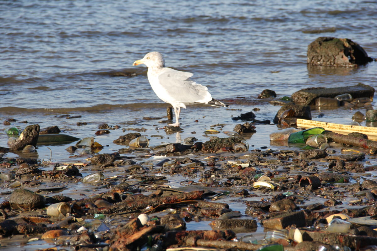
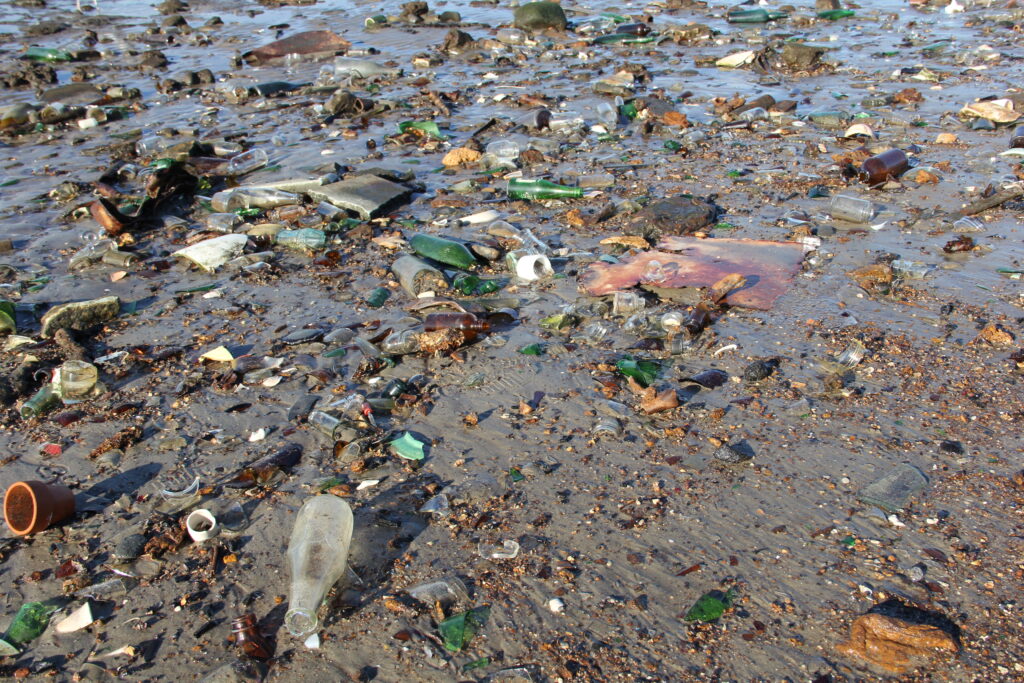
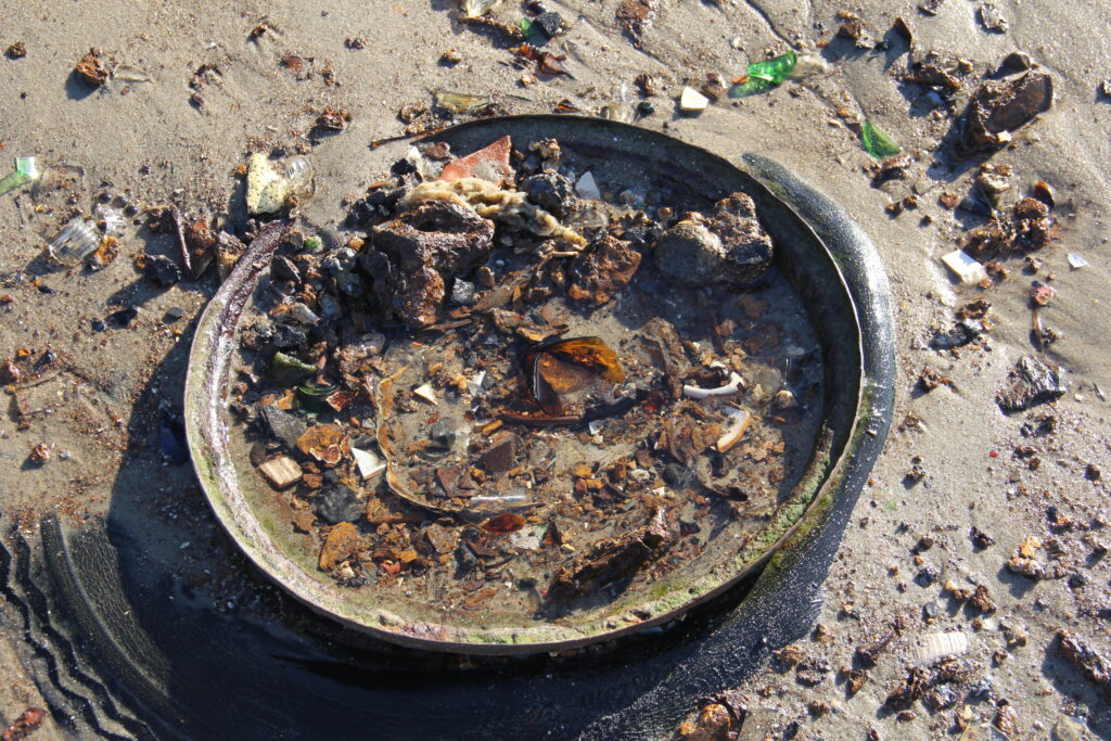
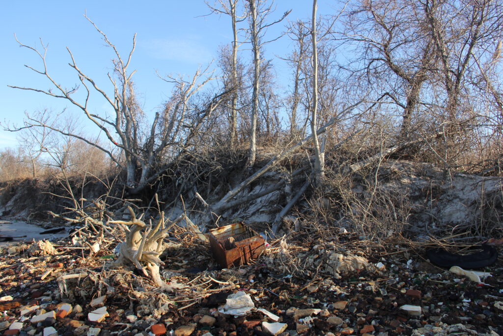
The area around Newtown Creek — which covers much of the current North Brooklyn Industrial Business Zone in Greenpoint and East Williamsburg — was used throughout the 19th and 20th-centuries to house oil storage facilities, manufactured gas plants, foundries, dry-cleaning businesses and oil and chemical refineries, a legacy that’s left it among America’s most polluted waterways. In 1978, a Coast Guard helicopter discovered the Greenpoint oil spill, one of the largest in US history, which would ultimately cause 17 million gallons of oil to seep into  the creek. After a series of lawsuits, ExxonMobil was ordered to pay for its cleanup. 

The Environmental Protection Agency declared Newtown Creek a federal superfund site in 2010, beginning a long remediation process set to finish by 2035. In addition to federal remediation efforts, state regulators at the DEC are conducting a Brownfield cleanup program to remove toxic soil from the area and limit contaminated stormwater runoff. 

The DEC’s Newtown Creek Upland Study aimed to identify potential sources of contamination from a handful of properties bordering the creek that are not already in a remediation program. However, Dudek urged that the results were only preliminary and that further investigation is needed. 

“It means that we need to look at them a little more carefully, maybe adjust some sampling if it’s already within a remedial program or see whether or not they need to be added to a remedial program,” Dudek said. 

Investigators first assessed the creek in 2021, looking for “seeps” — or locations where chemicals appeared to be entering the creek from the ground — and “sheens,” where petroleum residue accumulates along the water’s surface in a polychromatic film. After suspicious sites were identified, officials returned in 2022 and later in 2023 during low tide for subsequent sampling. 

Dudek discussed a few sites from the study in-depth. At 1301 Metropolitan Avenue, investigators found light petroleum contamination and verified that it once held an underground storage tank. Dudek confirmed that it would undergo a Track Four cleanup in 2026, which would remove groundwater contamination and cover toxic substances in the soil to prevent them from migrating to the surface. 

NYC Mega Projects coordinator Heidi-Marie Dudek presents study findings over Zoom at a community meeting on November 19.

At 4681 Metropolitan Avenue, investigators found volatile organic compounds (VOCs), carcinogenic substances that typically contain chlorine and are found in a variety of industrial chemicals. Though DEC investigators couldn’t find a direct source, they did install a soil-vapor-mitigation system to prevent VOCs from entering buildings on the property while a longer-term remediation plan is in the works, Dudek said. 

She assured residents that the DEC is working closely with the EPA to ensure all cleanup measures are coordinated with the EPA to ensure one agency isn’t undoing the other’s work.

“DEC is working in conjunction with EPA,” Dudek said “So we’re not doing this in isolation. We run all of the data and the RAPs (remedial action plan) through EPA to make sure that they concur that what we’re doing is going to be protective of their remedy too.” 

But residents who attended the meeting expressed frustration at the cleanup’s slow progress and concern that the DEC’s and EPA’s independent but sometimes overlapping remedial programs in the area may mean that regulators are underestimating the pollution’s extent. 

“A lot of work has gone into the site,” said Willis Elkins, a Sunnyside resident and Executive Director of the Newtown Creek Alliance. “But we don’t feel like a lot has been accomplished in terms of cleanup goals.” 

Elkins’ organization hosts youth workshops, volunteer cleanups and activities to restore the area’s environmental health and improve local access to Newtown Creek. Recently, the Newtown Creek Alliance held a joint “community share-out” with the Billion Oyster Project focused on restoring the creek’s mussel and oyster habitats. 

Before the arrival of European colonists, Newtown Creek was for many centuries filled with  plentiful fish, oysters, and waterfowl, which the indigenous Mespeatches people (the namesake of modern “Maspeth”) collected for food. Now, it’s hardly accessible to those living on its banks. 

”There are so many different layers of contamination in the area, and some are more of a direct hazard to folks than others are,” Elkins said. ”It’s impacting our ability to safely interact with the waterway.”

Camera Eye: A Visual Exploration of Glass Bottle Beach

By Christine Stoddard | cstoddard@queensledger.com

Photo by Christine Stoddard.

File photos c. 2021 of Glass Bottle Beach at Dead Horse Bay in Gateway National Recreation Area, on the outskirts of the Marine Park neighborhood. The site has been closed since 2020 due to hazardous levels of radioactivity. From 1948 into the mid-1950s, it was a landfill with a mound elevation of 25 feet. Now eroding, the shoreline features a patchwork of broken bottles, ceramics, metal objects, clothing, and a mix of random household and industrial items.

Photo by Christine Stoddard.

Photo by Christine Stoddard.

Photo by Christine Stoddard.

Photo by Christine Stoddard.

Photo by Christine Stoddard.

GLOwanus–Using Light To Influence Water Quality

Brooklynites can turn to this lantern made of recycled plastics the next time a city-issued waterbody advisory is issued.

By Lauren Peacock | news@queensledger.com

It’s scary to think that a combined sewer overflow (CSO) could be happening on your streets even when it’s not visibly flooding.

A CSO can be caused by as little as a 1/12 of an inch of rain and can result in sewage being carried into the Gowanus Canal, hindering clean-up efforts. At the time of a CSO, all water is diverted into the Gowanus Canal. By reducing water consumption, the CSO is reduced, keeping the canal healthier, cleaner, and vibrant.

GLOwanus was created to make NYC waterbody advisory alerts easier to understand for residents. When the city issues an alert for the Gowanus Canal, the lantern will emit vivid colors and continue to do so until the waterboard advisory is lifted. When the colored lights come on, this tells residents that they should be cutting back on their water usage, whether that be waiting to wash dishes, flush the toilet, or do the laundry.

GLOwanus was created by Francesca Bastianini (Sight Studio) and Steven Koller (Environmental Science and Policy PhD student), two fellows from Van Alen Institute’s Neighborhood Design Fellowship program, and was designed by artists Manav Singla and Ridima Jain.

The Gowanus Canals are a superfund site. According to Bastianini, this means that despite the rapid change and development of the neighborhood, it is still undergoing repair from a long history of pollution, and ongoing pollution from an overwhelmed sewer system.

According to Andrew Brown, the Director of Programs at Van Alen, when there’s no city-issued waterbody advisory, the light glows white. When an advisory is issued, the light flashes different rainbow colors. Each color doesn’t specifically mean something, but the rainbow colors are meant to draw people’s attention so that they realize there is a City-issued waterbody advisory, meaning there’s a good chance combined sewage overflow (CSO) has recently spilled or may soon spill into the Canal.

The lanterns are made out of recycled plastics, creating a durable and translucent product that transmits light all around and avoids creating new plastic. According to Bastianini, the prototype of the lantern was created from the VAI Gowanus fellowship in 2021, and the current product was completed in the fall of 2023.

Instructions for the open-source code and 3D printing for the lantern are available. Shiloah Coley, the Program Associate at Van Alen, says that providing this information to the public makes it easier for other communities and neighborhoods that are interested in creating a product like the GLOwanus lantern to do so.

“We learned so much working on this, and we want to make sure other communities and individuals have access to this knowledge and feel encouraged to build on it,” explained Coley.

Bastianini hopes that the GLOwanus lanterns will not only expand on a large public scale, but expand awareness, provide prompts and support for local advocacy, and keep “pressure on agencies to follow through with their local officials.”

Coley hopes the lanterns help Gowanus residents feel empowered by providing the information they need during a CSO.

“That way if they choose to, they can act and adjust their own water usage habits. It would be great to see other folks build on our open-source code to make light installations in other neighborhoods.”

Approximately 20 to 25 GLOwanus lanterns are left at time of press. If anyone is interested in picking one up, you can email Shiloah Coley at scoley@vanalen.org.

Why you should vote ‘Yes’ on Environmental Bond Measure

Voters across the state will have a question on their upcoming Nov. 8 ballot about whether the state should pass the Environmental Bond Measure. And we implore you to vote yes.

The Environmental Bond Measure would help unlock $4.2 billion for critical environmental spending by taking on debt, for issues including: at least $1.1 billion for flood risk and restoration, up to $1.5 billion for climate change mitigation, up to $650 million for land conservation and at least $650 million for water quality improvement. 

It’s a hefty cost, but a necessary one.

According to a 2020 report from State Comptroller Thomas DiNapoli, New York has the second highest debt burden behind California.

But the costs of doing nothing could reach a projected $10 billion per year (in 2010 dollars) by 2050, according to state reports.

We need to invest every dollar we can into fighting climate change.

It is an existential threat that requires long-term thinking and inaction will only make the situation worse.

With the surmounting costs of climate change, it would be better for the federal government to step in.

The Inflation Reduction Act brought some advancements in terms of federal dollars to help states battle climate change like tax credits for heat pumps and solar panels.

But due to the sniveling coward of a Senator Joe Manchin is, it was a compromise deal. 

We have very few options with how to deal with this issue. Inaction cannot be one of them.

So while adding more debt can be concerning to voters, the bigger costs are too big to ignore or delay.

Fill the Form for Events, Advertisement or Business Listing