COBB: A Nostalgic Stroll Down Greenpoint’s West Street

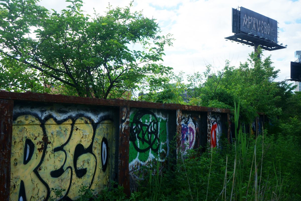
In the 19th Century, West Street was the center of the country’s shipbuilding industry. Image via historicgreenpoint.com

GEOFFREY COBB

Author, “Greenpoint Brooklyn’s Forgotten Past”

gcobb91839@Aol.com

No street in Greenpoint has lost more of its historic character than West Street, which runs parallel to the East River waterfront. Yet no other street in Greenpoint has been as transformed by gentrification as it has been. Let’s take a stroll up West Street and consider its fascinating history and massive transformation.

If we had strolled here in the 1850s, we would have seen a row of twelve shipyards extending the length of the street. We would have heard the din of hammers and saws as hundreds of shipwrights were building wooden sailing ships. In 1862 The most famous event in Greenpoint history occurred when the Continental Iron Works sent the ironclad battleship the Monitor into the East River at Quay and West Streets. The famous ship saved the Union in the Battle of Hampton Roads and spelled the end of an American navy of wooden sailing ships.

From the 1870s to the 1970s West Street was the home of the American Manufacturing Company, where at least 1,500 immigrant women created naval ropes and hemp bags. In 1910, the mostly female employees of the company fought the police in a pitched battle on West Street during a failed strike. From the late 1970s until 2005, West Street became a landscape of abandoned factories and vacant lots.

In the early 2000s a different kind of battle for West Street was occurring: rezoning. The Greenpoint waterfront had been zoned industrial and community leaders and outside developers agreed that the waterfront should be rezoned, but they envisioned very different futures. Members of the community drew up a plan that would preserve low-rise buildings, affordable housing and local industries, while outside developers envisioned lining the street with luxury, high-rise towers. Ignoring the warnings of famed urbanist, and author of the Death and Life of American Cities, Jane Jacobs, Mayor Bloomberg pushed through a rezoning favoring high-rise development.

Few events symbolize West Street’s transformation more than the fire of May 2, 2006, a suspicious fire claimed fifteen potentially landmark buildings that once housed the American Manufacturing Company, clearing the way for luxury high-rises to replace the historic structures. Today, only 67 West Street reminds us of the beautiful red brick buildings that once lined the streets, but it too is in the crosshairs of developers who want to replace it with another tower. The iconic water tower on Milton and West Streets that has defined the area also seems doomed.

So, what do locals say about Greenpoint’s most transformed street? They claim that the scale of the new West Street buildings bears little relationship to Greenpoint’s historic fabric of three- to five-story row houses, churches, and factories. The criticism is not simply that the buildings are tall, but that they create an entirely different skyline and neighborhood character from inland Greenpoint. When the 2005 rezoning was debated, many planners warned that allowing towers on the waterfront would permanently change Greenpoint’s identity. Residents repeatedly describe the result as a  wall of buildings separating the neighborhood from the river. One recurring local complaint is that the waterfront has become a collection of generic glass towers. To many longtime residents—including me—the new West Street feels soulless, its buildings disconnected from Greenpoint’s historic architecture.

That transformation is far from over. Monitor Point, at Quay and West Streets, will feature three generic glass and steel towers standing 600 feet, 450 feet, and 230 feet tall. These massive buildings will cast long shadows over Bushwick Inlet Park and nearby streets.

A walk down West Street is still a walk through Greenpoint’s history—but only if you know where to look. The shipyards are gone. The rope factory buildings have almost vanished. Most of the red-brick industrial buildings have disappeared behind glass towers, and even the neighborhood’s iconic water tower may soon follow. Unless the few surviving landmarks are preserved, future generations may never realize that one of America’s greatest industrial waterfronts once stood here.

Towards a Car-less Red Hook?

A new transportation plan for the Brooklyn Marine Terminal  proposes what would be the borough’s first “parking maximum”

BY JACK DELANEYjdelaney@queensledger.com

RED HOOK — City planners are aiming to eventually reduce car usage in Red Hook to only 16% of total trips through measures like a “parking maximum” and better bus service, according to a new proposal unveiled last week.

Since the redevelopment of a 122-acre chunk of Brooklyn’s waterfront was first floated in 2024, one of the surrounding community’s most vocal concerns has been transportation: In a neighborhood serviced by no subway lines and a single, notoriously-unreliable bus, how will the residents of thousands of new homes get around?

Two years later, the Economic Development Corporation (EDC) — the city entity in charge of the Brooklyn Marine Terminal (BMT) — finally has answers. But several prominent local leaders argue that they’re not the right ones, claiming that they’re unrealistic.

On Friday, July 31, the Brooklyn Marine Terminal Advisory Task Force convened online for its fifth meeting since a “vision plan” for the site was narrowly approved last fall, hearing updates from the Department of Transportation and transit consultants.

The session started off on rocky footing, with Assemblymember Jo Anne Simon criticizing the EDC’s decision to hold the meeting, which was open to the public, during the early afternoon in the summer — a time many constituents complained meant they could not attend. (The event was also recorded.)

“You may be doing work, that’s great. But for engagement, you need people to be around,” said Simon. “The level of frustration with this process is part and parcel with the fact that people feel like they’re being dismissed. That is not a good position from which to engage with the community going forward.”

Assemblymember Marcela Mitaynes agreed with Simon’s assessment, adding that it seemed as though the EDC was also discouraging feedback from the 32-member task force itself.

“You guys are reading off your whatever-it-is, and you’re barely giving us any time to follow along,” said Mitaynes.

The transit proposal looks to create a “car-lite, multimodal neighborhood” through several interventions: forced turns that discourage traffic on Columbia St to speed up buses, a biker-oriented greenway on Van Brundt St, and a cap — the first of its kind in Brooklyn — on the number of off-street parking spaces developers can build.

The lead planners behind the presentation, Jeff Smithline of TYLin and Sam Frommer of Buro Happold, explained that the system of forced turns would make Google Maps reroute cars heading for the nearby BQE elsewhere. Downplaying concerns about the impact on businesses along the strip, they stressed that drivers would still technically have full access to Columbia St and one-way southbound access to Van Brundt St.

Hank Gutman, a former commissioner of the DOT under Mayor Bill de Blasio and a current member of the task force, expressed skepticism about the scheme, which does restrict car traffic completely on Columbia St between Hamilton Ave and Woodhull St.

“I worked on a lot of bus priority projects — I’m not aware of any that had this Rube Goldberg aspect to it,” said Gutman, highlighting the potential burden placed on Congress St. “I don’t see this doing anything other than making an existing problem worse.”

Smithline was unfazed. “It is a unique street network, because of the limited crossings [over the BQE],” he replied. “But we were surprised at how few forced turns we needed in order to get traffic off of these streets.”

If completed, the $3.5 billion BMT redevelopment plan would add up to 6,000 housing units and rehabilitate the crumbling piers that sit largely underused along Red Hook’s rim. Unsurprisingly, this volume of apartments will generate “a lot of rides,” with a projected daily peak of 2,200 cars in circulation.

Yet the planners were explicit about their goal of ultimately phasing out cars. Mimicking an existing initiative in Manhattan, the proposed “parking maximum” draws from research suggesting that when spots are scarce, commuters are less likely to own cars. (The presentation did not specify what the cap will be, numerically.)

Additionally, the duo noted that they were in conversation with the DOT over upcoming changes to the BQE ditch — which divides the Columbia Street Waterfront portion of Red Hook from the inland brownstones of Carroll Gardens, rendering it an “island” — and promised to update their designs as that project moves forward.

But while Gutman and fellow task force member Carly Baker-Rice, who helms the Red Hook Business Alliance, blasted the proposal as impractical, others pushed the EDC to take action sooner rather than waiting until the apartment complexes are built.

“You guys need to make us feel comfortable by doing something now,” said Karen Blondel, a task force member and the tenant association president of Red Hook Houses West. “Don’t wait till the GPP. We want small wins out here, not just a big win. I shouldn’t have to be scared to sit down as a sixty-seven-year-old because nobody’s cleaning the bus stops.”

The task force held a public workshop on the transportation plan on August 5, and will be hosting open office hours on August 11 and August 20,  from 12 p.m. to 2 p.m. An EDC representative projected that the draft Environmental Impact Statement (EIS), the next stage of the land use process, will be completed by early next year.

Mamdani’s Plans to Build, Build, Build with LIFT Housing Tracker

The vacant municipal building at 44-36 Vernon Boulevard in LIC was listed on the interactive mapping tool.

BY COLE SINANIANcole@queensledger.com

Apartments atop a Bensonhurst library. A vacant lot along the LIC waterfront, developed into a soaring, mix-income condo tower.

These are just some of the affordable housing developments likely to come to City-owned parking lots, waterfronts, vacant land and public facilities in Brooklyn and Queens over the coming years, thanks to the newest initiative of Mayor Zohran Mamdani’s ambitious housing program.

Through an initiative dubbed LIFT — shorthand for the Land Inventory Fast Track Tracker — the Mamdani Administration hopes to utilize New York’s un- and underused public sites to build fast-tracked affordable housing, employing the expedited land-use review process that voters approved in the November election.

At a press conference Thursday, Mamdani and his cabinet announced the rollout of an interactive mapping tool that identifies more than 100 sites around the city that, if developed, could yield some 50,000 new apartments. The tracker — which includes already-approved projects — comes after the Mayor announced his LIFT task force upon taking office in January, which was directed to identify properties well-suited to affordable housing development.

“We have a responsibility to use every tool we have to build the affordable housing our city needs,” Mamdani said. “The LIFT tracker brings transparency to that work and makes clear that City-owned land is not sitting idle—it is becoming homes, libraries and community space across the five boroughs.”

The Administration has maintained it will keep an “aggressive pace” of Request For Proposals (RFPs) on City-owned land, vowing to issue RFPs for at least five new sites each year. This speed will help Mamdani reach his goal of building 200,000 affordable homes over the next ten years, as outlined in his ambitious Block by Block housing plan released earlier this year.

“We have already taken tangible steps forward on more than a dozen projects on public land that will create more than 5,000 new homes, and we are bringing unprecedented public transparency and engagement into this project with the release of the new LIFT tracker,” added Leila Bozorg, Deputy Mayor for Housing and Planning.

Already, the effects of LIFT are beginning to take shape.

In Bensonhurst, Brooklyn, the New Utrecht Library at 1743 86th St could soon see a new, 100% affordable apartment building built over its roof. The City released its RFP for the project in June, and developers have until September 4th to submit proposals. Officials have maintained that library service will not be interrupted during construction.

In Long Island City, meanwhile, a three-building, mixed-income development called The Orion will yield 980 apartments in the Hunter’s Point South area, 66% of which will be affordable at low-to-moderate income levels. Announced Wednesday, The Orion is set to include community facility space, a daycare and a workforce development center, an indoor community pool, and new commercial retail.

Student OMNY Cards: Digital or Physical?

Will Student OMNY Cards Go Digital? (Photo by Linda Chan)

BY LINDA CHANnews@queensledger.com

For New York City public schoolers who need to replace their lost or malfunctioning student transit cards — and there are many — the process can feel like a throw of the dice.

“One of my friends was able to get a replacement the day right after they requested it, because the school happened to have OMNY cards in stock,” said Julia, a rising junior at the Bronx High School of Science. “But when I requested mine, I waited about a month for my replacement to come.”

The current student OMNY system offers eligible students four rides a day, seven days a week, and at any time. The cards are valid from the beginning of the school year in September until the last day of August in the next year.

While this is a major upgrade from the previous student MetroCards, which only allowed three rides per school day from Monday through Friday between 5:30 a.m. to 8:30 p.m., many students and advocates argue that it is still far from enough.

Advocates at Riders Alliance, a non-profit who self proclaims they are “fighting for better transit for all New Yorkers,” have commented that while the “student OMNY as a policy is a big improvement over the previous system,” it does not work for all students the same way flawlessly, so a “more durable option would be a big help.”

The old MetroCards, made from thin plastic, were equally prone to being misplaced. But the MTA’s shift in September 2024 to the new system, OMNY, has brought its own unique headaches: Across dozens of interviews, students complained of paper cards disintegrating in the rain, or ceasing to work abruptly.

In the first three months of the 2025–26 school year, for example, Stuyvesant High School received 528 replacement forms, per a City Council hearing earlier this spring. Over half of them, 284, were due to malfunctions.

At a City Council hearing on March 23, Stuyvesant student Jiaxiang Zhang joins his peers in criticizing the current OMNY cards. (Photo via NYCCC)

Now the DOE and MTA are experimenting with a possible solution: going digital.

Seven schools have been identified to participate in the initial rollout of digital cards as part of a pilot program. The DOE has remained tight-lipped about the initiative, but a spokesperson said more details would be released once testing is completed.

Many students reacted positively to the potential shift.

“Since I constantly use my phone throughout the day, a digital OMNY card will make it less of a hassle in case I forget the physical card,” said Sylvia, a rising senior from Bronx Science.

“I’d choose digital for convenience to prevent the risk of losing the physical card,” agreed Jamisha, a rising senior at the Manhattan Center for Science and Mathematics. “Paper is not durable at all — it’s very flimsy, and that’s not good.”

Some students have taken efforts to laminate their cards, despite being highly discouraged by school administrators. While the lamination can cause heat damage, which interferes with the OMNY card readers, this has become the only way for some students to protect their fragile cards.

Quin-Niya Contreras holds up her student OMNY card, made from paper, that has begun to disintegrate in the lower left corner. (Photo: Linda Chan)

Cubic Transportation Systems Corp., the manufacturer of OMNY cards, did not respond to a request for comment regarding the reason behind making student the cards paper instead of a more durable material.

Yet other students say that even though the paper cards’ quality is unreliable, they would still prefer them over the digital option.

“I think I would still want the physical card because it will be easier for me, and I don’t have to worry about my phone dying or having problems,” said Angela, a rising junior at Flushing High School.

“My phone would usually be dead before I get home, so having a digital one would be kind of hard to manage in that case,” added Quin-Niya, a rising junior at the Young Women’s Leadership School of the Bronx. “I would stick to the physical card.”

To some transit advocates, including Riders Alliance, the answer to the debate seems simple: Why not offer both physical and digital cards?

“It’s no secret that the transition has been long and windy, but most people are using OMNY and complaints have lessened,” a spokesperson for the group said. “Students and their families should have both options available.”

G’pointers Blast Transmitter Park Proposal

A proposal for WNYC Transmitter Park, still in its early stages, would see two restaurateurs open a dining spot and seasonal programming in the marina. (Photo: NYC Parks)

BY JACK DELANEYjdelaney@queensledger.com

A swanky restaurant and expanded marina may be coming to one of Greenpoint’s most high-traffic parks — but not if residents have any say in the matter.

Last week, the local group Friends of Transmitter Park revealed that the waterfront green space — which was opened in 2012 as WNYC Transmitter Park, after a previous life as a radio transmission station — was being considered for an “activation” that would offer seasonal boat tours, marine-themed programming, and a new dining destination.

A preliminary document suggests that the Parks Department is poised to give a 25-year lease to restaurant veterans Josh Cohen and David Schmitt. Cohen is a longtime resident active with local organizations like North Brooklyn Angels, per reporting by the blog Greenpointers; Schmitt operates two locations elsewhere in the city, DJ’s at Bayside and Dakota’s on the Cove, that both sit next to marinas.

“While our community widely supports the addition of a public restroom and a small, contextual place to grab food or coffee, we are working to ensure the project doesn’t overwhelm the park,” the Friends said in a statement. “We want to reinforce a strong need to protect the historic Art Deco building structure, scale down the restaurant, and rethink the large commercial marina footprint to protect the park’s quiet, passive character and natural estuary and research station, along with expansive views, that allows our small green park to reach out into the blue water.

Greenpointers echoed those sentiments, pointing to the extensive options for shopping and meals along the nearby strips of West St and Greenpoint Ave.

“This peaceful park is a special refuge for so many residents and visitors,” said Danielle Harris on Instagram. “We don’t want a marina, we don’t want water sports, we don’t even want a restaurant here (there are several to choose from just a few feet from the entrance!). We just wanted a functional public bathroom! This is one of the ONLY places in the neighborhood where you can enjoy something at no cost.”

Local rep Emily Gallagher said that she “felt much better” about the activation after she and Councilmember Lincoln Restler met with parks officials, noting that their plans differed from what was in the circulated documents.

The Parks Department will be hosting a virtual community meeting on the proposed changes to Transmitter Park on Thursday, August 6 from 6 p.m. to 7 p.m. A full hearing will be taking place on August 10 at 2:30 p.m. at 255 Greenwich Street.

COBB: City Hall to Greenpoint: Drop Dead

A rendering of Greenpoint’s controversial Monitor Point towers, were the City Council approved last month.

GEOFFREY COBB

Author, “Greenpoint Brooklyn’s Forgotten Past”

gcobb91839@Aol.com

There is an old saying that “you can’t fight City Hall,” and nowhere has it rung truer than in Greenpoint, where city officials have repeatedly overridden the wishes of neighborhood residents. While researching my new history of the neighborhood, Greenpoint’s Forgotten Stories, I found that this pattern stretches back decades.

One of the chapters in my book describes the destruction of Oakland Street, which was once a pretty, cobblestoned street lined with quaint, wooden frame houses. Against the wishes of Greenpointers, the city condemned about a hundred houses on the East side of Oakland Street, forcing some 450 families to relocate, many outside the area. The city destroyed Oakland Street so that it could create the ugly six-lane McGuinness Boulevard that still cuts like a gash through the neighborhood. Borough President Cashmore even ignored residents’ pleas for a meeting to discuss the creation of the motorway, showing his contempt for local sentiment.

By 2005, the abandoned factories lining Greenpoint’s waterfront had become the focus of one of the fiercest land-use battles in New York City. Residents saw a chance to redevelop the waterfront without sacrificing Greenpoint’s historic character and created their own community plan. Developers, meanwhile, saw hundreds of acres of prime waterfront real estate capable of generating billions of dollars in luxury housing.

The outcome would help determine whether Greenpoint retained much of its working-class character or became one of Brooklyn’s epicenters of gentrification.

Mayor Bloomberg sided with developers who proposed transforming the waterfront into a wall of high-rise luxury towers.

One of the nation’s most respected urban thinkers agreed with Greenpoint residents. Jane Jacobs, author of The Death and Life of Great American Cities, urged Mayor Bloomberg to reject the city’s proposal and instead adopt the community’s plan. The famous urbanist argued that successful urban renewal grew gradually from the wishes of existing communities rather than from massive redevelopment projects.

Jacobs warned Bloomberg saying, “I will make two predictions with utter confidence. 1. If you follow the community’s plan you will harvest a success. 2. If you follow the proposal before you today, you will maybe enrich a few heedless and ignorant developers, but at the cost of an ugly and intractable mistake.”

The waterfront has since become one of New York City’s most visible symbols of gentrification, leading to a spike in rents and forcing the exodus of many long-term residents. Today the waterfront is lined with a phalanx of glass-and-steel towers that bear little relationship to Greenpoint’s traditional low-rise streetscape.

When the area was rezoned in 2005, residents were promised that they would benefit by finally receiving waterfront parkland. Bushwick Inlet Park, nestled along the East River, was designated and planned as part of that rezoning, pleasing Greenpoint residents.

Jane Jacobs, whose famous book, the Death and Life of American Cities, challenged the notion that city planners know best. Photo via Wikimedia.

Controversy later centered on an 80,730-square-foot MTA-owned parcel adjacent to Bushwick Inlet Park. Many locals wanted to see it added to the park, while developers planned to build a massive, sixty-story tower that would cast a huge shadow over the park and the surrounding area. Although many residents opposed the proposed sixty-story tower, arguing that it would cast a substantial shadow over the park and overwhelm the surrounding neighborhood, Borough President Antonio Reynoso and Council Member Lincoln Restler supported the project because it included affordable housing. Once again, City Hall sided with large-scale development over the preferences expressed by many neighborhood residents.

Developers continue to build many more luxury towers, transforming what was once a low-rise waterfront neighborhood into what some residents now call “Dubai on the East River.”

Each tower represents a victory for gentrification and a setback for those seeking to preserve Greenpoint’s traditional scale.

Greenpoint has always changed, and no neighborhood can remain frozen in time. The question is whether change should be shaped primarily by the people who live there or by outside economic interests. Oakland Street, the 2005 waterfront rezoning, and today’s battles over Bushwick Inlet Park are separated by nearly seventy years, yet they tell remarkably similar stories. The city has repeatedly ignored the wishes of Greenpoint residents.  For many Greenpointers, that history explains why the old saying still rings true: you can’t fight City Hall.

Tasting the Caribbean

At a two-day festival in Bed-Stuy, attendees and vendors bonded over cocoa-bean juice, a Trinidadian twist on cinnamon rolls, and more

By Christian Spencer

news@queensledger.com

Brooklyn’s Taste the Caribbean Food Festival brought together countless cultures and cuisines! (Photos by Christian Spencer)

BED-STUY – Late last month, the Taste the Caribbean USA event brought together Caribbean communities in Brooklyn through food, music, and culture.

Vendors from across the region served traditional dishes while attendees explored the different flavors, traditions, and histories that connect the Caribbean diaspora.

Sassy Ramoutar, founder and executive director of the OMSA Foundation and organizer of the event, said the festival was created to recognize the diversity within the Caribbean community.

When asked how long she had been involved in this type of work, Ramoutar responded, “My whole life.”

This marked the first year of the festival, which Ramoutar said came from her passion for seeing Caribbean communities represented throughout New York City.

“Because I really enjoy seeing the diversity of Caribbean people in New York City,” she said.

Ramoutar, whose family is from Trinidad, said the event was designed to introduce people to the many cultures represented throughout the Caribbean.

“We think it’s really important, and that’s why we held this event,” Ramoutar said. “A lot of people think Caribbeans are just one people, but within the Caribbean diaspora there are so many different cultures and races.”

Ramoutar pointed to the many communities that make up the Caribbean, including Afro-Caribbean, Indo-Caribbean, and Asian Caribbean populations.

She said food, music, and community gatherings provide an opportunity for people to learn about those different backgrounds.

Ramoutar estimated that approximately 3,000 people attended the festival the previous day, with the event running from 11 a.m. to 8 p.m.

Mark Persaud, an attorney with Mallilo & Grossman, attended the festival while supporting the OMSA Foundation.

Persaud, whose parents are from Guyana, said events like the festival provide a way for people to connect with Caribbean heritage.

“So, I’m out here for Caribbean Heritage with the OMSA Foundation,” Persaud said.

He said he has participated in similar community events over the past three years, using them as opportunities to engage with residents and make legal resources more accessible.

“Food is like a language, I think, right?” Persaud said.

He discussed how Caribbean islands often share similar dishes while adding their own regional influences, including the differences between Guyanese “chicken curry” and Trinidadian “curry chicken.”

“I’d say just come together and have a good time, right?” Persaud said. He described the festival as an opportunity for New Yorkers to slow down, enjoy different foods, and experience Caribbean culture.

Alexandra Dennis represented Cocoa Bean Juice and Salad Bar, a Haitian-owned business that combines Caribbean flavors with healthier food options.

“For Cocoa Bean, we represent Cocoa Bean Juice and Salad Bar, which is really trying to bring in Caribbean flavors while promoting healthy eating,” Dennis said.

Dennis, who was born in Haiti, said the business serves customers from across the Caribbean community.

“Food is a very huge source of energy,” she said, explaining that food plays a role in both nourishment and bringing families together.

“We keep the healthy aspect in there,” Dennis said, describing the company’s use of alternatives such as oat milk, almond milk, hemp milk, and coconut milk in its drinks. Her message to attendees was simple: “Welcome to the Caribbean. Brooklyn is the Caribbean.”

Amber Ho-Shing, owner of Delicious Snacks and Things, brought a fusion of flavors influenced by her Jamaican, Panamanian, and Chinese heritage. “It’s like part of our DNA, who we are as a people,” Ho-Shing said about the role food plays in culture.

Ho-Shing said her business sold out the previous day, forcing her to reorganize her menu and prepare new items within hours.

“That we bring delicious food made from the heart, and it’s a cultural blend,” she said, describing her approach to combining Caribbean, Asian, Mediterranean, and other culinary influences.

Karen Cooper brought Trinidad-inspired cinnamon rolls featuring traditional spices and flavors.

She said Caribbean food reflects the region’s creativity and encouraged attendees to explore cuisines beyond their own backgrounds.

“The Caribbean has a lot of flavor, taste, and spices,” Cooper said.

Trisha Davidson represented Guyana at the festival and spoke about how food connects people across cultures.

“They must come out and support the different cultures,” Davidson said, encouraging attendees to experience the different traditions represented at the event.

Derek Bahadur, a Queens resident originally from Guyana, attended the festival for the first time to explore the different cuisines available.

“Caribbean food is healthy food,” Bahadur said while discussing his appreciation for the region’s cooking traditions.

Tamika Smith, who represented Jamaica, said the spices used in Caribbean cooking were what attracted her most to the festival.

“Being open to different types of dishes,” Smith said when describing what she hoped visitors would take away from the event.

Keisha Graham, a former neighborhood resident, attended to reconnect with familiar Caribbean flavors.

She said she hoped visitors would discover local restaurants and businesses they had not previously known about.

“Finding restaurants they didn’t know existed,” Graham said.

70 Maps, 1 Atlas: Brooklynite Launches Interactive NYC Atlas

Brooklyn-based urban planner Bahij Chancey designed the current version of NYC Atlas in a single week, after years of iterating on the idea. (Photo courtesy of Chancey)

A Brooklyn MIT alum combines cartography and art to create an interactive database of NYC, with all 70 maps in one place.

BY JACK DELANEY | jdelaney@queensledger.com

Which NYC neighborhood has the most rats? The best bagels? The widest sidewalks? The greatest density of pizzerias? (Spoiler: not Little Italy.)  And what did your block look like in 1940? 1800? 1609? What melody would you hear if each subway line played its own note as trains arrived at a station?

You can find answers to all these questions and more on NYC Atlas, a free online catalogue of nearly 70 interactive maps recently launched by Bahij Chancey.

Growing up, Chancey would gaze at the world map on his bedroom wall as he fell asleep, overcome with a bittersweet sense of FOMO.

“I never wanted to go to sleep,” said Chancey. “I always felt like I was missing something. But when I could see the whole world, I knew that there were places where it was still daytime.”

At age 35, Chancey has built a career around his love of maps — a trained architectural draughtsman with degrees from MIT and Yale, he now serves as the managing director of WXY Studios, one of the city’s premier urban planning outfits.

But Chancey has another equally fervent passion: civic engagement. Before WXY, Chancey worked at the nonprofit Green City Force, sat on the board of the advocacy group Transportation Alternatives, volunteered for the Parks Department through AmeriCorps, and joined Brooklyn’s Community Board 6 as a public member.

NYC Atlas marries Chancey’s overlapping interests, gathering a collection of maps that are just as likely to make you laugh with pure cartographic appreciation as they are to inspire you to call your local representative.

“What I like about most of the maps on this site is they’re pretty accessible,” said Chancey, a longtime resident of northwest Brooklyn. “People are able to dig in and find out information about the city that I think in many cases is hidden.”

The idea for NYC Atlas had been bouncing around Chancey’s head for years, as he slowly accumulated a spreadsheet of his favorite finds — he even built several prototypes, though he was never satisfied with any of them.

But the site officially released in April, thanks in part to AI tools that sped up the development process. The first iteration of the current look only took one week to make, which “completely shocked” Chancey, who leaned on back-end platforms like Vercel and Superbase that wouldn’t be expensive to maintain.

“This was a late night thing for me,” said Chancey. “My partner jokes that after she goes to bed at 10 p.m. is when I get into my crazy projects.”

While NYC Atlas initially centered on utilitarian entries like election maps, the catalogue now includes a wide range of playful creations that blur the line between cartography and art.

One of Chancey’s favorites from this camp is “Everything is Everything,” by Mark Varley and Jessi Highet. This zany map of bagel shops throughout the city was conceived as a companion piece to the couple’s main endeavor at the time: Walking five marathons per week, or 7,000 miles total, around the five boroughs over the course of a single year.

The catalogue ranges from the silly — a guide to the best and worst bagels in all five boroughs (above) — to the practical, like a round-up of community board schedules.

Although Varley and Highet stopped updating “Everything is Everything” in 2024, it still holds 202 starred reviews of the city’s best and worst bagels, with the top two honors going to Queens and Brooklyn — Hot Bagels in Middle Village received the sole 5-star nod, with Olde Brooklyn Bagel Shoppe in Prospect Heights following closely behind at 4.75. (The exercise also yielded such nuggets of wisdom as “Toasting raises the floor of a bagel but lowers the ceiling,” and “An irregularly shaped bagel will almost always taste better than a perfectly round bagel.”)

NYC Atlas boasts a thriving history section, too: photographs dating back to the 1800s sit alongside noise complaints from the Roaring Twenties, plus a compendium of biographical details about the people behind co-named streets.

Yet no map takes a longer view than “Welikia,” a collaboration between Eric Anderson and the New York Botanical Garden that leverages both archival research and ecological data to visualize the city as it existed in 1609. Users can slide the timeline to watch the Rockaways disappear underwater; this journalist’s childhood home in Carroll Gardens was once a thick forest of oaks and hickories, opening onto a salt marsh.

Chancey came across some maps by chance, and many emerged through meeting fellow urban planners via work. Others he had to coax into existence: “Rat Map,” by Chancey’s high school classmate Evan Coleman, was originally a dashboard of rat sightings by zip code that Chancey asked his friend to turn into a map.

Ultimately, Chancey hopes that NYC Atlas will do more than entertain. He envisions it as one part of a larger work-in-progress, tentatively titled New York City Civics, that could incorporate a wiki and video series to demystify the inner workings of local government.

“I ended up building this first because it feels like a helpful and interesting standalone tool,” said Chancey. “But I’m really passionate about how people engage with government, and how people use their power as a citizen or resident of a place in order to shape their communities and their city.”

Ridgewood’s Nepalese Oasis Looks to the Future

Photos: Cole Sinanian

Chef and rapper Bikash Kharel is upgrading his restaurant, While In Kathmandu, for uncertain times. 

BY COLE SINANIAN

cole@queensledger.com 

Opening a restaurant devoted exclusively to Nepalese food, a cuisine not well-known to the American palate, is always a risk in New York City, says Bikash Kharel. 

But Kharel — a rapper, music-producer, chef, and the owner of While In Kathmandu on Seneca Avenue — has never been one to shy away from risk. Born in Nepal and raised in Ridgewood, Kharel inherited a life in the restaurant business from his father, who ran the aptly named Nepalese Indian Restaurant just a few blocks away from 2012 until 2022. It was, however, heavier on the Indian than the Nepalese, catering primarily to the older, take-out-focused local crowd who came for the sorts of dishes they’d come to expect from the rice-and-curry-forward South Asian cuisine most commonly found stateside. It was familiar Indian fare, easy on American tastebuds, though quite distinct from the dishes Kharel grew up eating as a child in the Chitwan region of southern Nepal, from which the family emigrated in 2006, when Kharel was 13. 

Jhol Momos, for example — Nepalese steamed dumplings served swimming in a rich, bright-orange sauce —  did not sell like the curries did. Nor did the Thakali Thali, an impressive traditional platter of pickled vegetables, lentil soup, crispy soybeans, grilled egg and delicately spiced chunks of aromatic chicken called Choila. Rice looks different in Nepal, a Himalayan country marked by deep valleys and jagged mountain peaks, making traditional rice cultivation difficult. Here, they eat an oat-like form of beaten rice known as Baji, or a savory puffed rice, called Gophuki. 

“Nepali  food is a unique identity itself,” Kharel said. “Not selling curries, not selling rice, that was a very bold decision.”

But the Ridgewood of Kharel’s youth is not the Ridgewood of 2012, which is not the Ridgewood of today. Like many New York City neighborhoods, Ridgewood has grown into a trendier, younger version of its former self, with waves of artsy transplants starting to spill over from Bushwick in the 2010s, bringing with them a new dining scene to match. Now, nearby destination restaurants like Hellbender or Rolo’s grace the pages of the New Yorker, and Kharel has tailored his business model accordingly. 

With the neighborhood’s new arrivals and their more adventurous, ethnically curious palates, Kharel saw opportunity. 

“A lot of people talk shit about the newer demographics,” Kharel said, “but I feel like they’re more open to things. They have a bit of Christopher Columbus syndrome,” he said. “They want to discover shit.” 

Photos: Cole Sinanian

With the blessing of his father, Kharel set about opening a restaurant that would cater to this new  demographic. Although he is Hindu, Kharel was at this point making beats and rapping in Nepali under the moniker “Funky Buddha” In Nepal, the Buddha is a cultural figure more than a religious one, admired by Hindus and Buddhists alike, Kharel said. 

He took the summer of 2016 to travel around Nepal in a van, exploring the country he’d only ever known as a child. Three weeks of this trip were spent in Kathmandu, the capital, where he worked with local artists to record samples of traditional music— a project that resulted in his mixtape, called “While in Kathmandu.” 

In 2017, upon his return from Nepal, Kahrel opened the restaurant, which he named after the mixtape. Initially, the concept was “the first Nepalese coffee shop and bar in New York,” a laid-back Nepalese cafe and breakfast spot by day and bar by night, offering small, tapas-style Nepalese bites throughout. 

The menu, based mainly on the cuisine of the Newar people of Nepal’s Kathmandu Valley, wasn’t supposed to be the main event, but after a glowing New York Times review from September 2017 hailed his Nepalese-New Yorker fusion an instant neighborhood classic, the floodgates were opened. Suddenly, he was getting travelers from Brooklyn, Manhattan and beyond showing up to the bar at night, long after the kitchen had closed, asking for dinner.  

“I would see a horde of people coming in, their faces dropping because they trekked all the way out here and realized that the restaurant is not open,” Kharel said. 

Seeing the opportunity, Kharel pivoted, adjusting the restaurant’s concept to full-dinner service with food as the primary focus. But despite his recent local acclaim — with outlets like Eater and The Infatuation offering up rave reviews — Kharel says business has been better. Though he’s fortunate to have a good relationship with his landlord, whose rent hikes Kharel described as reasonable, relatively speaking, sales continue to decline. People aren’t eating out like they used to, Kharel says. Weekends and dinners are packed, but lunchtime is routinely dead. While in Kathmandu’s dreamy covered back patio remains closed simply because the space hasn’t been needed. It’s of course not the customers’ fault, Kharel acknowledged. He recognizes the effects of New York City’s affordability crisis on New Yorkers’ spending habits. 

But sales are sales, and a restaurant must net a minimum profit to stay operational, driving Kharel in search of creative solutions. He’s working on what he calls a “scaleable Nepalese food culture brand” that would offer something like the Nepalese fast-casual version of Kava or Sweetgreen. In the meantime, Kharel plans to tweak While In Kathmandu’s concept yet again, hoping to bring it closer to his original vision of a cafe by day and bar by night, with a seasonal menu that pushes the boundaries of novelty while maintaining its Nepalese roots. Though Kharel was adamant that the restaurant’s essential vibe would not change, he did say he would soon be adding a stage for nightly concerts in the dining room’s far corner. 

He says the community has been largely supportive of the coming changes, which he announced on Reddit late last year. 

“There’s a lot of love behind it, and I felt that too,” Kharel said. “It made me feel more like this is my home. Like it’s important for me to be doing what I’m doing.”


After Church Blaze, Bushwick Residents Fear Same Fate for Similar Historic Buildings

The Bushwick United Methodist Church. (Photo: Bushwick United Methodist Church on Facebook).

BY COLE SINANIAN 

cole@queensledger.com

Take a stroll down Bushwick Avenue, and you’ll find the forces of neighborhood change on full display: On one corner, a glistening condo tower of glass, sheetrock and sharp angles. On another, a picturesque row of brownstones — like the 19th-century Ulmer Rowhouses — or  the towering brick steeple of the Bethesda Baptist Church, a striking example of late-romantic architecture built in 1896. 

Bushwick, which traces its roots to a 17th-century Dutch settlement, displays a rich architectural heritage. But as the neighborhood gentrifies and historic structures — many of which lack protection under the City’s Landmarks Preservation Commission (LPC) — face slow decline, some residents fear these buildings could soon be lost. 

“I’m concerned about all of our surviving properties,” said Dina Alfano, co-founder of the Bushwick Historic Preservation Association (BHPA). “We’ve just lost so much, and we continue to fight to protect what remains.” 

Her concerns are well-justified. On June 19th, the South Bushwick Reformed Church — among the oldest churches in Brooklyn and known locally for its tall white steeple — burned to the ground in a dramatic blaze that left the community in shock. Quickly, rumors began spreading of foul-play, with the Fire Department ultimately confirming to Brownstoner that the fire is under investigation as arson. With the steeple unsalvageable and a portion of the church’s parish hall structurally compromised, the City moved to demolish what remained of it earlier this month, before abruptly halting the scheduled demolition on July 14. 

The Parish Hall of the ruined South Bushwick Reformed Church on Friday, July 17. (Photo: Cole Sinanian).

On Friday, July 17, the lot remained walled-off, with a posted Department of Buildings (DOB) sign indicating that demolition would be completed in August. But according to Alfano, the City is giving the church’s pastor, Reverend James Steward, time to assess the damage with his own contractors in the hopes of ultimately restoring the 173-year-old structure. 

It’s crucial that the hall remains standing, Alfano said, as it would allow the property to keep its landmark status, preventing it from being sold to developers. 

“The good news is that we’ve managed to keep the landmark,” she said. “As long as the parish hall is still there, the property can maintain its landmark status, and we get to hold on to that history.”

But it’s a different story for the neighborhood’s other old buildings. The BHPA has kept a list of historically significant properties on and around Bushwick Avenue that could qualify for landmark status. Some, like the iconic “Mayor’s Row” — an alignment of near-identical, 2.5-story rowhouses built in 1889, where former NYC Mayor John Hylan once lived — the BHPA has designated as in “serious danger” of alteration or redevelopment due to current zoning conditions. 

Historic buildings in Brooklyn have been divided or demolished to make way for development in the past. In 2008, a congregation in Bay Ridge decided to demolish its Bay Ridge United Methodist Church to make way for market-rate housing, and use the $9.75 million made from the sale to rebuild the sanctuary. But the new church was never built, and ten years later, the entire lot had been sold to developers. 

Also on the BHPA’s high-risk list is the Bushwick United Methodist Church on the corner of Bushwick Avenue and Madison Street. Built in 1887, the church is noted for its unique, octagonal Renaissance Revival tower constructed in red sandstone and gray brick. 

There’s also the Bethesda Baptist Church, which sits only blocks away from the South Bushwick Reformed Church’s ruins. Built in 1896 and exemplary of the late Romantic style, the church was recently operated as a vintage store, before the City put it under vacate order in 2023. Last Friday it appeared vacant, the front door bolted and debris strewn throughout the property. 

Brooklyn Community Board 4 Chair and Bushwick resident Robert Camacho, who’s lived in the area his entire life, suggested Bushwick’s increasingly lucrative housing market has a role to play in the decline of the neighborhood’s historic buildings. He said both himself and neighbors receive regular calls and emails from real estate companies looking to buy their properties for redevelopment. 

“They want to get rid of Bushwick,” Camacho said. “They don’t even need to demolish it.” 

Alfano said her organization plans to arrange a meeting with the Landmarks Preservation Commission to discuss getting these historic sites under landmark status. 

“Once history’s gone, there’s no getting it back,” she said. “There are plenty of new buildings sprouting up here and there. But once these old buildings that have tales to tell are gone, they’re gone, and there’s no getting them back.”

Fill the Form for Events, Advertisement or Business Listing