Gutiérrez joins BetaNYC and North Brooklyn Parks Alliance in Mapping Equity Project

A digital map of a housing complex in Brooklyn in light green, grey and different shades of white. Small black spots marking different amenities are spread throughout the map.

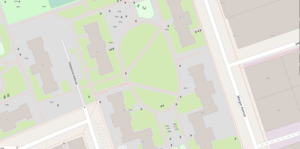
Cooper Park Houses, which a group of attendees learned to map during the event, as mapped on OpenStreetMap.

By Carmo Moniz | [email protected]

A program run by BetaNYC, the North Brooklyn Parks Alliance and councilmember Jennifer Gutiérrez’s office is looking to make data on public resources in the city more equitable across communities, making it easier for communities to advocate for their needs.

The program, called Mapping for Equity, focuses on areas that have been mapped in the least detail. The program uses OpenStreetMap, a mapping software that allows the public to contribute to its features, to map amenities like benches, trash cans, playgrounds and more in public spaces. 

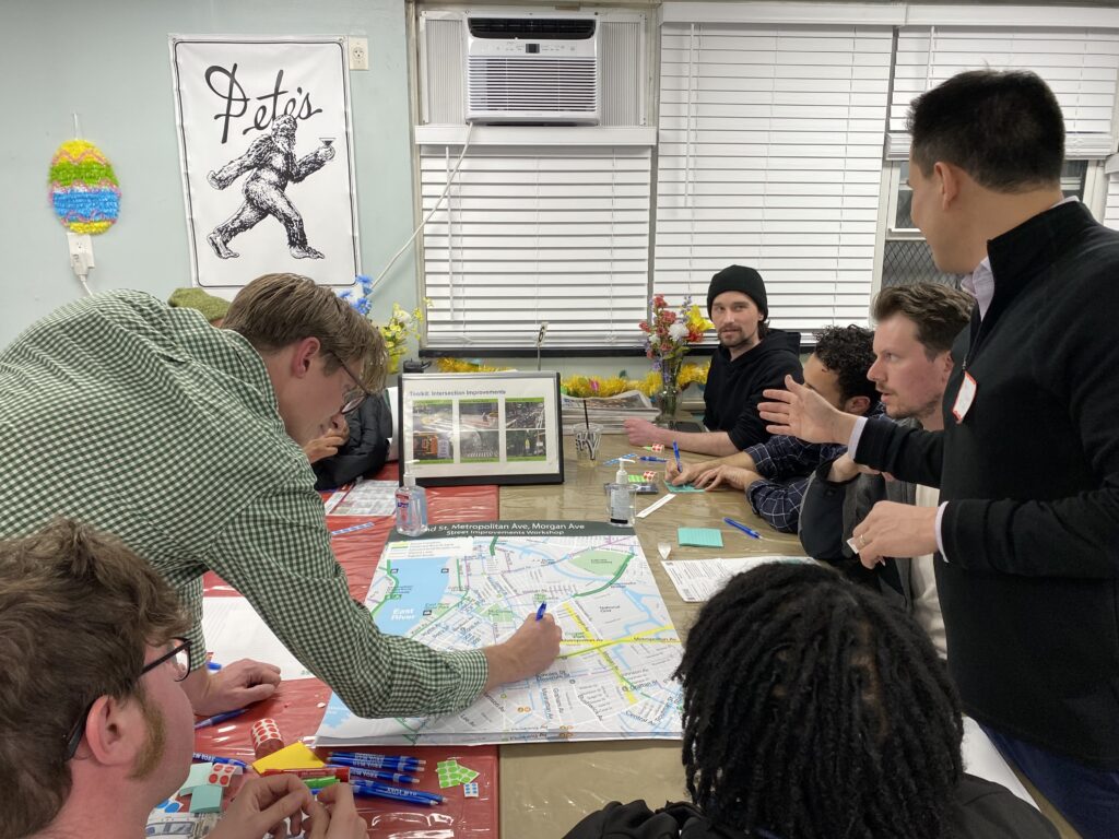
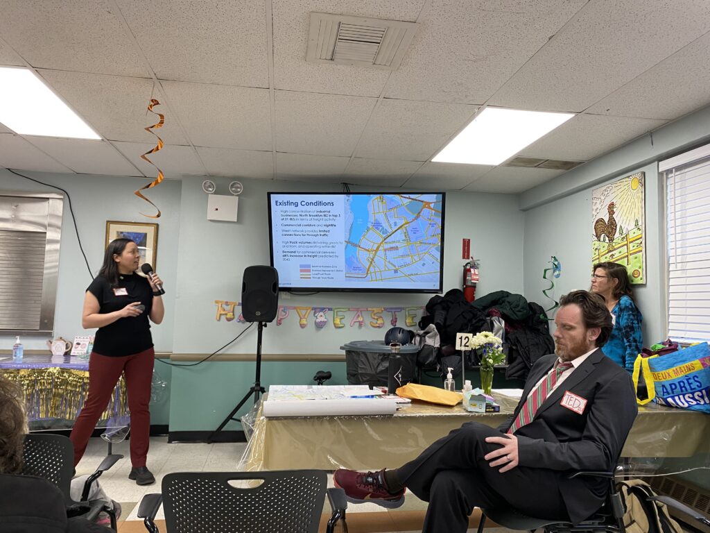
BetaNYC, NBPA and Gutiérrez’s office held a launch event for the program last Monday, where they presented the results of their mapping efforts thus far.

Karrie Witkin, a representative for the North Brooklyn Parks Alliance, said that the mapping tool could be useful for the organization as it is focused on the maintenance of public amenities in parks. 

“We’re very interested in this tool from a planning perspective and figuring out where we need to be and how to get our services equitably distributed throughout the district,” Witkin said at the event. “This is an exciting tool, it makes visible so much that’s invisible in our maps.”

On OpenStreetMap, wealthier areas are often mapped in greater detail than low-income neighborhoods, which can make using data based arguments for better resources in those neighborhoods difficult, according to the BetaNYC website.

Attendees were able to try mapping for themselves during a field section of the event, and were encouraged to later add their findings to OpenStreetMap. Reverend Dr. Katie Cumiskey, a professor at the College of Staten Island who attended the event, said she hopes to replicate the mapping process on Staten Island.

“It’s really important that citizens of our city feel empowered to be involved in how the city comes to understand the neighborhoods that they live in, especially for those folks who live in public housing or neighborhoods that have been historically excluded or underserved by the city,” Cumiskey said in an interview. “BetaNYC has a really fun and cool way for folks to feel like they can engage with how the city interprets and views their neighborhoods.”

BetaNYC has had two cohorts of Civic Innovation Fellows, all City University of New York students who were matched with the fellowship through a university program, participate in the Mapping for Equity program. Together, the two cohorts mapped over 5,100 features in OpenStreetMap, according to BetaNYC fellowship manager Jazzy Smith.

Kinji Donald, one of the fellows who worked on the project, said that once features are uploaded to OpenStreetMap, they take around a week to be visible to the public.

“I feel like I’m actually making a change and helping the public,” Donald said in an interview. “Hopefully we can see certain patterns that will allow us to see areas that may need more amenities, or may have a lot of damaged amenities that need fixing, and we can take care of.” 

Noel Hidalgo, BetaNYC’s executive director and a Technology & Democracy fellow at Harvard University’s Ash Center for Democratic Governance and Innovation, said he hopes to work with nonprofit organizations and other community groups to use the mapping data for advocacy purposes.

“The fight for open data is about getting the opportunity for everyone, not just government, take the information and use it for analytical purposes,” Hidalgo said in the interview. “Something that we’re very, very passionate about is figuring out how communities and individuals can take that information and use it for their local advocacy purposes.”

Anya Lehr, Gutiérrez’s senior adviser, said that as chair of the New York City Council’s Technology Committee, the councilmember has seen the inequalities caused by technological infrastructure, and that it can be difficult to make arguments for addressing issues in a community without quantitative data to back them. 

“When she started thinking about all the other inequalities, which there are a lot from a long time of not having investments, the thing that we would always do is go ‘well where’s the data?’” Lehr said at the event. “Super excited to be working on this project with everyone, as soon as we saw this, as soon as Jazzy showed us what came out of this, it was like ‘this is awesome.’” 

Hidalgo said BetaNYC began working with Councilmember Gutiérrez around a year ago, and that she had continued the work of her predecessor, now Brooklyn Borough President Antonio Reynoso, in providing funding for the organization’s data literacy work. 

BetaNYC has been running literacy classes for OpenData, a government platform that includes public datasets ranging from crime statistics to film permit data, since former New York City Mayor Michael Bloomberg passed the “Open Data Law” in 2012. The law required that by the end of 2018,  all public datasets be accessible on a single portal online.

Hidalgo said that the organization uses mapping to teach how to use OpenData, an idea that arose when gathering in office spaces for literacy programs became difficult due to the pandemic. He also said that the next step in the project is working with BetaNYC’s community partners, such as NBPA, and teaching them to run data collecting events, data entry and how to maintain the data.

“This project is just one rung in the ladder of a very long ladder of data literacy,” Hidalgo said in the interview. “We now have a nuts-to-soup perspective of how to teach and how to collect data, and walk you as the general public into the context of collecting data.”

DOT Hosts Redesign Workshop for North BK Streets

A Department of Transportation representative facilitated the discussion in each group and answered logistical questions that arose.

By Iryna Shkurhan | [email protected]

With stickers, markers and post-its in hand, North Brooklyn residents set out to redesign some of the most widely used, and problematic, corridors in their neighborhood.

The Department of Transportation (DOT) hosted the revisioning event on Thursday evening at the Swinging Sixties Senior Center on Ainslie Street. With over a hundred community members in attendance, no seat was left empty. The strong turnout and vocal attendees reflected the desire for a long awaited redesign that prioritizes safety and accessibility in the community.

The conversation centered around three main roadways — Grand Street, Metropolitan Avenue and Morgan Avenue — which are heavily utilized by pedestrians, cars, bus commuters, bicyclists and trucks on a daily basis. The event directly showed that accommodating everyone’s interests is tricky, with several possible solutions to consider.

A presentation by Lauren Rennée, a DOT project manager, outlined the changes implemented at these three locations over the past decade to address usability, especially for the growing number of cyclists. A “toolbox” of possibilities to address the issues that remain included one-way car conversion, removing a lane of parking, reducing travel lanes and sheltering bike lanes with either parking or jersey barriers.

The area that encompasses Williamsburg and Greenpoint ranks in the top-third of high-crash corridors in Brooklyn, according to the DOT. On Grand Street, 22 people were seriously injured between 2016 and 2020. Since 2016, there have also been seven fatalities. The crash rates were only slightly lower on Metropolitan Ave and Morgan Ave.

“There are a lot of challenges with the current design,” said Jennifer Gutiérrez, Council Member of District 34 representing Bushwick and Williamsburg, in her opening remarks. “We’re also here because there have been very real collisions and deaths along these corridors. Our goal before anything is to prevent all of those deaths.”

The central complaint of the evening was that the majority of the time, the bike lanes in all three locations were unusable due to parked cars or trucks blocking them. With poor access and visibility, bicyclists are forced to either disturb pedestrians on the sidewalks or put themselves at risk by riding into car designated lanes. But some business owners countered that bike lanes pose curb access challenges for deliveries and limited parking for visitors.

“I bike on Grand St and it’s very problematic, depending on which way you’re going,” said Francesca Romana Caputo, a Williamsburg resident. “There is always something parked on the bike lane.”

Attendees were seperated into a dozen breakout groups where they spent 45 minutes discussing possibilities for solutions with a map of the area open between them. Using color coded stickers, they marked problematic areas with a corresponding note.

Each group had a DOT representative to guide the conversation, offer their expertise while another representative diligently took notes of popular solutions. It was suggested 15 minutes of discussion is allotted to each corridor, but Metropolitan Ave received the most attention, and complaints.

“We want to design streets that enforce themselves,” said Preston Johnson, a DOT Project Manager who led the discussion in one of the groups.

Metropolitan Ave’s current design bans parking on the peak direction side during rush hour west of the Metropolitan Ave Bridge. And over 1,700 vehicles cross that bridge during the morning rush, according to DOT data. And east of the bridge, the wider section of the road is separated by a median with just a standard bike lane in place.

A Department of Transportation representative delivered a presentation on the issues affecting all three corridors.

Cyclists are growing at a fast rate in the city and are a central population that will be considered in the redesign. According to DOT data, 1.8 million Citi bike trips originated in Brooklyn’s Community Board 1 in 2022, not including personal bikes. It is also the most environmentally friendly mode of transportation.

A popular solution was to implement protected bike lanes that provide a safer dedicated space for cyclists. According to the DOT it is the “most appropriate treatment in areas with commercial and industrial activity.” Pedestrian injuries decreased by 21 percent and motor vehicle occupant injuries went down by 15 percent when protected bike lanes were introduced.

Grand St, which connects western Queens and Bushwick to Brooklyn and Manhattan via bridges and the BQE, generates high truck volumes and loading demand by serving commercial and industrial areas. Much progress has been made since 2008, when travel lanes had no separation or designation for bike riders. The following year, standard bike lanes were added and in 2018 they became parking protected curbside bike lanes. Last year, jersey barrier protection was also added.

Some bus riders complained that buses are forced to operate at slower speeds due to traffic, which leads to longer commute times for riders. They also complained that there is no enforcement of people illegally parking on bike lanes or blocking bus stops and lanes.

High truck rates stem from North Brooklyn being a hub for Industrial Business Zones. On Grand St, a lack of designated loading zones for trucks is a strong contributor to blocked bike lanes.

Many attendees proposed converting one or more of the three corridors into one-way roads to create more space for bike lanes and reduce congestion created by cars and trucks. Some attendees worried that by redesigning a large street as a one-way, smaller side streets that are currently favorable to biking will receive an influx of truck traffic.

Morgan Ave is one of the few north-south streets in Williamsburg that intersects Grand St and Metropolitan Ave. While a curbside bike lane was installed from Grand St to Grattan St in 2018, there is currently a bike network gap north of Grand St to Meeker Ave, Queens via the Kosciuszko and Pulaski Bridges.

Physically narrower roadways, one example of self-enforcing design, tend to discourage speeding that is present in wider roadways. They will also shorten crossing distances for pedestrians, a significant challenge for seniors.

Seniors make up less than 15 percent of the city’s population but over 45 percent of pedestrian fatalities. And 90 percent of senior and non-senior adult injuries occur at intersections. A proposed solution with seniors in mind is to include a halfway pedestrian island to split up intersection crossing into two parts.

”The other thing that no one has mentioned during this presentation is the pollution,” said Caputo, who lives directly on Grand St. She said that every morning a thick layer of black residue accumulates on the windowsill in her bedroom. “It’s insane. This is what we’re breathing everyday.”

The DOT plans to unveil their redesign proposal, created with resident suggestions in mind, at an upcoming Community Board 1 meeting.

Fill the Form for Events, Advertisement or Business Listing